The Main Canal is exactly what it says...
the Main Canal between the Danube and the Rhine Rivers.
The frost on the ground and you can just see in the
top left section of the photo what looks like a concrete wall!
Well it is ...it is the marker for the Great Divide.
The highest point, or the Watershed between the Rivers.
Having had the rapid flow of the river it seams strange
to see the glass like canal waters.
On two occasions we actually go on a Canal Bridge.
With the houses and pasture lands below us.
This being the second Canal Bridge.
At one of the lochs, we picked up a guest who
gave us a talk as to the history and construction of the said Canal.
With lots of diagrams..
the one above giving how many trucks or rail cars would
carry the same as one ship on the canal.
As you can see from the above chart the amount of cargo has been declining over the years.
The original thoughts where that there would be very little if any pleasure
transportation on the Canal...how wrong can you be!
The design of the Ships now means that most lochs can only handle one at a time.
You see here the number of lochs that we are now encountering
as we steadily decent down the other side of the Great Divide.
The lochs are all around the 12 meter size,
another prerequisite for the Ships who are 11.45 meters wide.
As it is a canal they still do not want the water to escape so each loch
has a water saving system by which 60% of the water is reused.
\
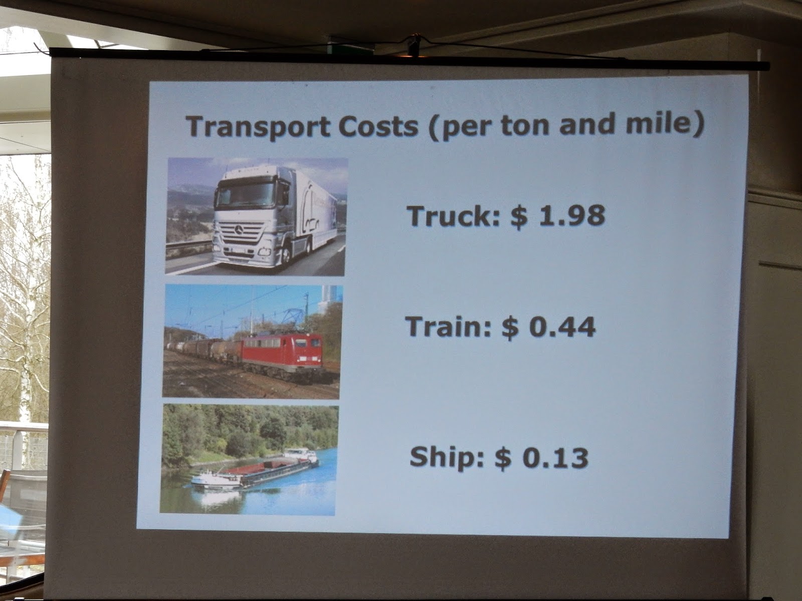
Here are two more charts. The one above shows the cost of freight.
Although the Ship cost is so much lower the time con-straights of the
modern day make it a lot less attractive.
So now you can see that the 39% Passenger Cruises has the
biggest increase in resent years and is getting bigger every year.
One of the 12 meter lochs....not much room to spare.
Going down...one of three 24.7 meter drops.
Then the bottom door rises and off we go again.


No comments:
Post a Comment